Bouldering Gym to Base Camp: LAB Member Kai Zinn Treks Kangchenjunga
By Kai Zinn.
Nepal is an amazing place to visit, whether one goes just to see the country or to climb and trek in the Himalaya. Due to media coverage, many people have been under the impression that much of the country was destroyed by the 2015 earthquake, and tourism has dropped precipitously as a result. In reality, while some areas were heavily damaged (and many people in those areas were killed), most of Nepal remains untouched, and the infrastructure is as functional now as it ever was. Trekking and climbing there is as easy to do now as in the past.
Most people who trek in Nepal go to one of a few very popular areas, such as Everest and Annapurna Base Camps. However, there are many other areas that are just as spectacular and are far less heavily trafficked. Going to these places allows one to have much more contact with Nepali people, and to avoid overcrowding by other foreign visitors. Having been on several treks and climbs in Nepal, this time I wanted to visit an area of eastern Nepal that only sees about 300 trekkers per year (vs. 45,000 in the Everest area): the base camps of Kangchenjunga.
Kangchenjunga is the third highest mountain in the world at 28,169 feet. It rests on the border between Nepal and Sikkim, a state of India, and is actually not one mountain but a huge massif with many peaka. Eastern Nepal is very lush, and the trek goes from subtropical river valleys at 2,000 feet to glaciers at 17,000 feet. The Kangchenjunga trek is probably one of the best treks in the Himalaya because of its beauty and unspoiled nature. Starting in the lowlands, it circles around the Kangchenjunga massif, climbs to the north base camp, then goes over several passes to reach a valley leading to the south base camp.
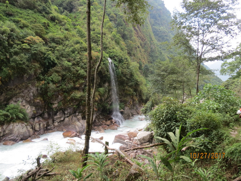
Ghunsa Khola, a lush jungle valley along the Tamur river.
Because this area is not frequently visited, trekkers are required to travel with a guide, and most people (including our group) hire a trekking agency with porters. This is a good idea in any case, because the lodges in this area are infrequent and not well supplied, and it can be hard to be self-sufficient. For those who want more information, you can see a detailed description of this trek here; however, this is not the company we used. Trekking agencies based in the US or Europe are very expensive, and we have always used an agency in Kathmandu. This allows one to work directly with Sherpas to plan trips, and Nepali companies are much cheaper. I can highly recommend the agency we used this time, Windhorse Trekking.
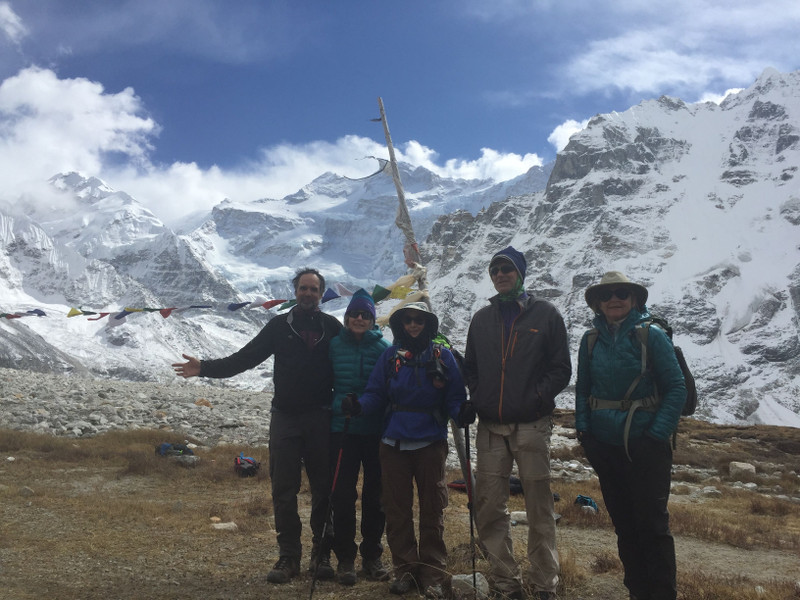
We had a group of six friends from California and Texas. Ang Karma Sherpa, a famous Sherpa who owns Windhorse, was in Nepal when we arrived (he normally lives in Portland, Oregon), and decided to go along with us. This was great because his perfect English allowed him to answer any questions we had. We then had two Sherpa guides, Lhakpa and Sonam, a cook, and 11 porters who were hired locally from the area at the start of the trek.

We arrived in Kathmandu, were met at the airport by Samden Sherpa of Windhorse, and stayed in Kathmandu for two days to sightsee and get trekking permits. We then flew with Ang Karma and Sonam to Bhadrapur in the Terai, which is the flat region in the southern part of Nepal. From there we hired a Jeep and drove for about 14 hours through the hills of middle Nepal to Taplejung, a small town where the trek starts. We met Lhakpa and the porters there.
From Taplejung the route drops into the Tamur river valley at 3,000 feet, climbs up through subtropical rice and cardamom plantations for two days, then turns up a narrow and precipitous side valley called the Ghunsa Khola. This is lush jungle terrain. The Ghunsa Khola climbs up to the Sherpa village of Ghunsa at about 11,500 feet. We took a rest day for acclimatization there and then continued up to Kambachen at 13,500 feet. From there we took a side trip to the base camp on the north side of Jannu, which is the sacred peak of the Limbu people.

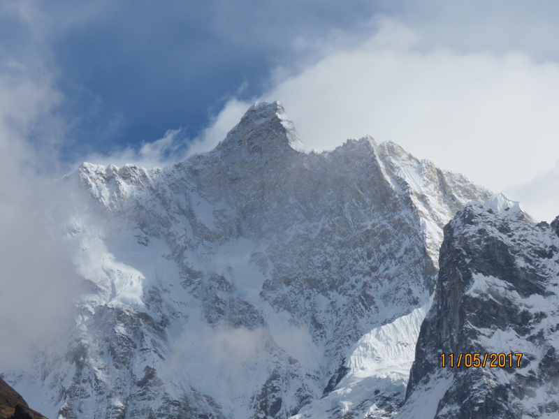
Jannu is an amazing mountain. It resembles an eagle from this side. Its north face is 11,000 feet high, and the top of the face is 4,000 feet of overhanging ice-plastered rock, running from 21,000 feet to the top at 25,300 feet. Amazingly, this was climbed in a 70-day siege ascent in 2004. A pair of Russians did a one week alpine-style ascent of the West Pillar, which is to the right of the direct north face, in 2007. To the left of the north face is the Wall of Shadows route, which has been climbed several times, first by a Japanese team.
From Kambachen we continued up to Lhonak, a yak grazing area and the highest Sherpa village at 16,000 feet. We then did a day hike to the north Kangchenjunga base camp at Pang Pema at 17,000 feet. The north face of the mountain is seldom climbed, due to major avalanche danger from the numerous seracs. The first ascent was by a British team led by Doug Scott in 1979.
From Pang Pema we descended back to Ghunsa, then climbed over a series of passes at 16,000 feet to reach the Sembuwa Khola on the other side of Kangchenjunga. These passes have amazing views of the other side of Jannu. We then hiked back up the Sembuwa Khola to reach the Yalung base camp area on the south side. This is the base camp used for the first ascent by the British in 1955, and most subsequent ascents have used their route, climbing the couloir on the left side of the south flank and then following the left-hand ridge to the top.

The back side of Jannu
From the south base camp, the route descends down the valley through beautiful alpine forests, then goes over a lower pass and descends back to a road at 4,000 feet. From there we again hired a Jeep and drove back to the airport in the Terai, then flew back to Kathmandu. In total, the trip was 20 days of hiking and is about 200 miles long.
Altitude was not a big problem for most of us because we allowed ourselves eight days to go from 3,000 feet to 17,000 feet. This gave us enough time to acclimatize. However, one still walks much more slowly at high altitude, and it is very cold up there in November.
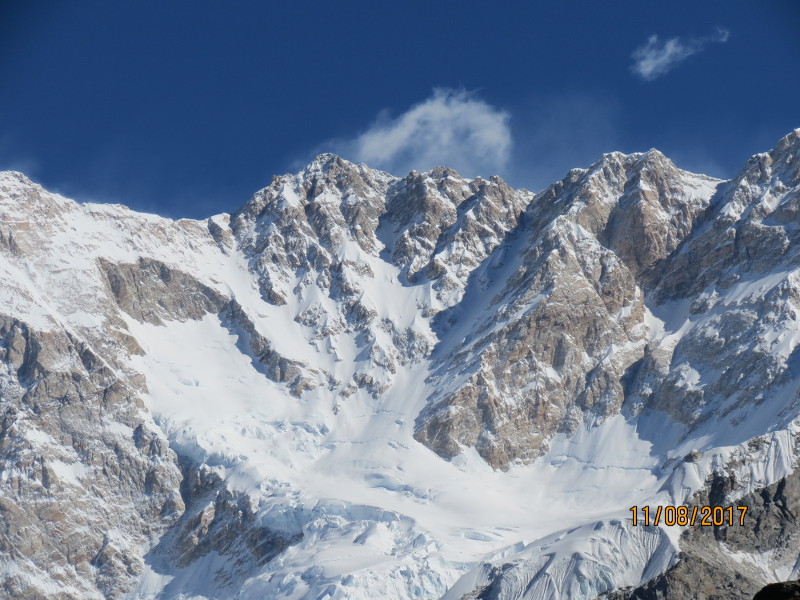
View from Yalung. Most ascents climb the couloir on the left side of the south flank, then follow the left-hand ridge to the top.
There are many other great trekking routes in Nepal that are not heavily traveled. These include Makalu Base Camp, the Dhaulagiri circuit, and the Manaslu circuit. For even more adventure, one can follow parts of a route that traverses the entire northern border of Nepal, the Great Himalayan Trail (GHT). Our friend Jean-Claude Latombe has done this entire route in about 200 days of hiking, and there are detailed descriptions on his webpage. The GHT includes some areas that are almost never visited by foreigners, and where there are few defined trails.
Finally, one can of course climb in the Nepal Himalaya. There are trekking peaks, up to 21,500 feet in height, which can be done with a small group and a trekking permit. Many of these still have difficult, unclimbed routes. Higher peaks require an expedition permit. Trekking and climbing agencies, including Windhorse, can handle logistics for climbing trips. More information and photos of trekking peaks can be found at Project Himalaya.
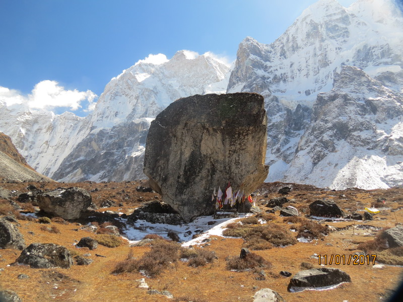
Base camp on the north side of Jannu, the sacred peak of the Limbu people